All posts

OOI Pioneer Array workshop

Thank you to the OOIFB and Pioneer Array data team for a terrific workshop this week in Norfolk, VA. The workshop provided an overview of the data, science and outreach opportunities offered by the array, relocated to our backyard earlier this year (see this link for details from OOI). I see PA as the closest thing to a particle accelerator or large telescope facility that our oceanographic research community has access to.

It will be exciting to integrate and compare our upcoming TEAL-SHIPS results with PA collections and continue to make regional connections. Some preliminary analysis courtesy of the Global Drifter Program surface floats suggests a ~10 day time scale for surface material from near the TEAL-SHIPS transect (see the magenta line in the above plot) to arrive at the array.

New paper on the influence of ocean currents on the carbon cycle

In regions where surface ocean CO2 concentration is less than the atmosphere, the ocean functions as a net sink for atmospheric carbon. How strong is this sink and what determines it?

Dr. Jesse Vance has published one of his thesis chapters where a 20 year shipboard time series of pCO2 is combined with satellite and ocean model data to show that advection of gradients by ocean currents contributes significantly to the seasonal to decadal time scale of variability in the strength of this sink. Click this link for the full article.

TEAL-SHIPS proposal funded!

Along with several UNCW colleagues and UNC system partners, our proposal to sample the waters of the Cape Fear river plume out to the Gulf Stream has been funded! We have named the project Transect Expedition To Assess Land-To-Sea Habitats Via Interdisciplinary Process Studies (TEAL-SHIPS), and will be collecting measurements in collaboration with the Cape Fear Community College research vessel, the RV Cape Hatteras. Many more details to come over the next several years as we get this project underway.

FishFry 3 complete and OOI Data Lab

What a week here in Wilmington! We completed our 3rd successful deployment around Frying Pan Shoals and UNCW CMS hosted an OOI Data Lab. I am very grateful for the Operations staff here who completed the recovery operation in record time.

Second, what a treat to see Kim Albins again! As lead PISCO technician, Kim was instrumental in helping me deploy/recover moorings for my thesis research at OSU circa 2009 – 2012. She is now a faculty member at the University of Mobile (welcome to Academia!). From sea-otter to sea-hawk, I figured some flashback photos were in order:

FishFry2 complete!

This one had me nervous. We deployed our second array on February 15th, a terrifically calm day that went off without a hitch. A planned 20-day deployment is only now complete and has turned into a 53-day duration experiment. How did that happen? Well, turns out it was exceedingly challenging to find a time with co-operative weather such that the boat and dive team could operate.

Here is a plot of wind speed and significant wave height at an offshore buoy during this deployment. I have added red dots to show the daily-average of the values.

Our team cannot operate safely when wind speeds are above 10 kts (5 m/s) or when waves are above 3 ft (1m), thresholds are indicated with a red dashed line. Notice there have not been many days recently where both conditions are met. I was then curious to know if this was “typical” for this time of year? Luckily NDBC buoys have long records of winds and waves.

Here now are climatologies of the average number of acceptable weather days per month based on 20 years of buoy data. Lo and behold, the average can be as low as 3 days/month…and of course, the month with the lowest average falls in February.

So in retrospect, I guess I could have anticipated weather and scheduling related difficulties with this deployment period. I will be ready for this next year. Special shout-out to the field team and collaborators who were ready to step up at a moments notice to retrieve our gear while I was elsewhere this week.

Ocean Sciences 2024 is here!

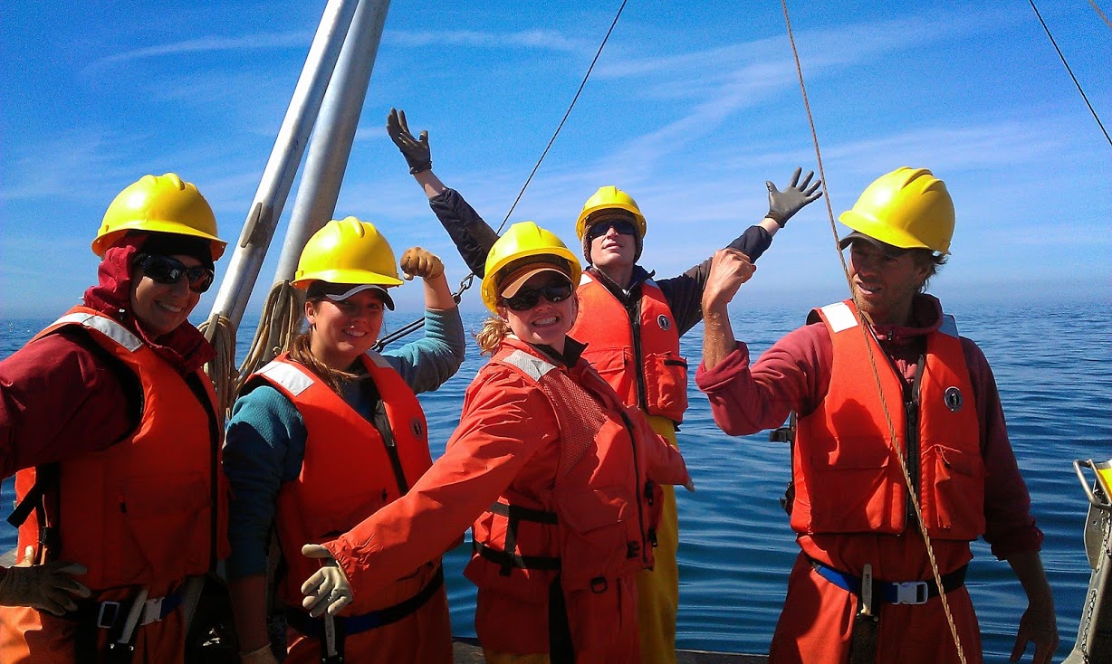
If you are looking for a session and/or talks to see next week, check these out:

Monday, 02/19/24

2:00 – 3:00 pm CP13A: Nearshore Processes III Oral

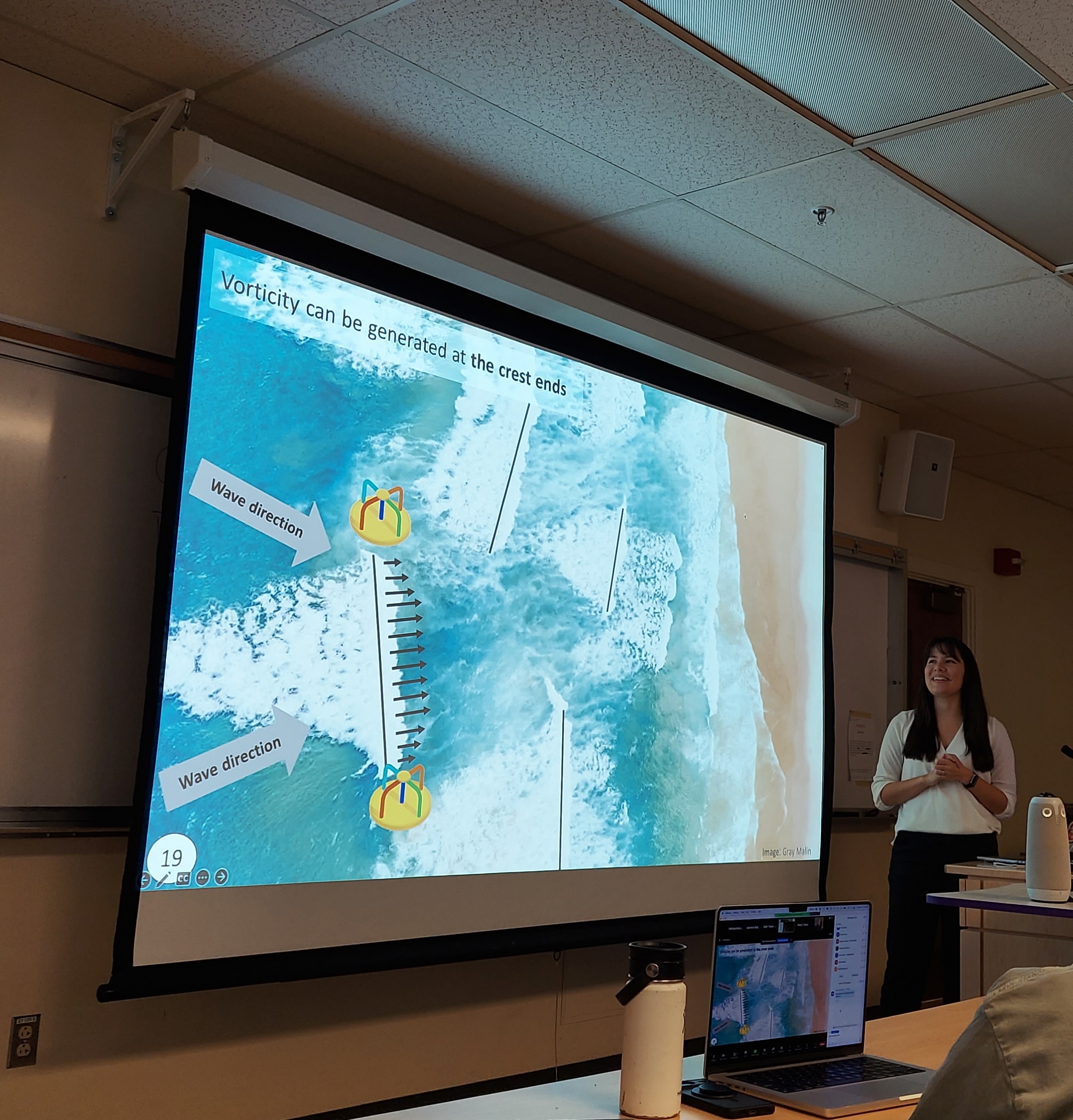
“Modeled surf-zone eddies on a laboratory scale barred beach with varying wave period and directional spread” by Emma Shie Nuss (CP13A-05)
4:00 – 6:00 pm CP14B: Nearshore Processes IV Posters

“Spectral Wave Frictional Energy Dissipation Over Rocky Bathymetry” by Noah Clark (CP14B-1792)

Tuesday, 02/20/24

2:00 – 3:30 pm CP23B: Nearshore Processes VI Oral

“Modeling wave energy dissipation by bottom friction on rocky shores at the Monterey Peninsula, Central California” by Cesar Acevedo Ramirez (CP23B-02)
” Observations of Wave Dissipation by Bottom Friction on a Rough Rocky Shore” by Olavo Marques (CP23B-03)

2:00 – 3:30 pm CP23A: Coastal Ocean Modeling in Support of the Decisionmaking Process for Emergency Response, Resilience, Navigation, and the Blue Economy II Oral

“Pathways of cross-shelf exchange in a submarine canyon environment, Aotearoa New Zealand” by Phellipe Couto (CP23A-07)

Thursday, 02/22/24

4:00 – 6:00 pm CP44A: Buoyancy-Driven Flows in Estuaries and Continental Shelves IV Poster

“Developing a framework for the components of the baroclinic momentum balance on the inner shelf” by Andrea Rodriguez-Marin Freudmann (CP44A-1897)

4:00 – 6:00 pm CP44D: Mixing in Shelf Seas, the Nearshore, and Estuarine Environments I Poster
“Estimating Dissipation by Internal Waves from Moored Thermistor Chains” by Jacqueline McSweeney (CP44D-1951)

4:00 – 6:00 pm PI44A: Biophysical Interactions in the Southern Ocean Across Spatiotemporal Scales II Poster
“Episodic Summer Chlorophyll-a Blooms Driven by Along-Front Winds at Aotearoa’s Southeast Shelf Break Front” by Erik Johnson (PI44A-1723)


ROXSI site visit to St. Thomas

The ROXSI team just returned from a wonderful visit to the site of our next field experiment, the northwest shore of St. Thomas, USVI. Thank you to our great hosts from partner institution, UVI who showed us around the rugged volcanic coastline of the island by land and by sea. The variation in what can be consider a “rocky” coastline is truly remarkable. Surge channels and rocky caves, 30 degree cliff faces, sharp points, all within a couple kilometers! This is going to be a fascinating next couple of years.

FishFry1 complete

Just before the weather turned, we were able to get out there and recover the array deployed for our first deployment on Frying Pan Shoals. The sea fuzz and muck were serious. Clean up and data download is gonna be a blast!

Moana Project closes

The Moana Project officially comes to a close this month. It has been a pleasure to work with the scientists and students to produce well-evaluated numerical products, collaborate with geneticists, chemists, and aquaculture specialists. We always hope that our work has impact! I was honored to visit and stay at the Whakatōhea Maori marae on the first hui, and was sorry to miss the final one. The Moana Project output, news and highlights are recorded here:

https://www.moanaproject.org/

and one more shout out to Dr. Mireya Montaño and the coastal Bay of Plenty model. Watch summer/winter particle releases and drifts: